
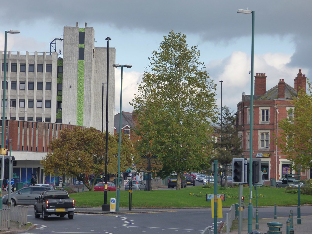
Acocks Green may not immediately scream “Regency history”. Usually it screams “temporary traffic lights” and “avoidable suspension damage”. But long before Birmingham expanded around it, this was a rural Worcestershire hamlet of coaching roads, canal boats, farmland, toll gates, and ordinary families navigating enormous social and economic change. This post explores the surprisingly rich Regency history hidden beneath one very familiar Birmingham suburb, with stagecoaches, industrial expansion, muddy roads, absorbed villages, and at least one entirely justified complaint about modern potholes along the way.
When I think about Acocks Green, I do not immediately picture Regency history. I picture my childhood. I picture ordinary suburban Birmingham: buses, shopping parades, traffic lights, roadworks that appear to have become permanent geographical features, and potholes capable of swallowing an entire Mini Cooper whole. The sort of place you pass through without particularly imagining that anything historically significant ever happened there.
And yet, beneath the modern Birmingham traffic sits a much older landscape of coaching roads, canals, farmland, inns, and ordinary families living on the edge of a rapidly expanding industrial town.
The more I started looking into the history of the area where I spent my own childhood, the more fascinating it became. I lived in Acocks Green until I was eight years old and, like most children, gave absolutely no thought whatsoever to the centuries of history quietly sitting underneath my feet at the time. Which feels slightly ungrateful now, really. At no point did I stop to consider that Regency travellers, canal workers, farmers, and stagecoach passengers had once moved through exactly the same landscape.
During the Regency period, Acocks Green was not suburbia at all. It was countryside. Real countryside. Fields, muddy lanes, scattered farms, toll roads, canal boats, and travellers making their slow way between Birmingham and London by horse and coach.
A Rural Hamlet on Birmingham’s Edge
During the Regency period, Acocks Green was not part of Birmingham at all. It sat within the ancient parish of Yardley in Worcestershire, several miles beyond Birmingham’s edge. In fact, Yardley did not officially become part of Birmingham until 1911, which feels surprisingly recent considering how firmly people now associate Acocks Green with the city today. The boundaries we think of as fixed are often remarkably modern once you start looking closely at them.
In the early nineteenth century, Birmingham itself was expanding rapidly, but the countryside still began remarkably quickly once you moved beyond places like Digbeth and Deritend. Acocks Green was largely rural. Not “leafy suburb” rural in the modern estate-agent sense, but actual countryside consisting of scattered farms, isolated cottages, orchards, pasture, coaching inns, muddy lanes, and hedgerows dividing farmland.
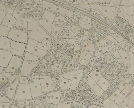
The name itself came from the Acock family, who owned land in the area from at least the seventeenth century. Historians believe the original settlement sat slightly further east along the Warwick Road near Acocks Green House rather than around the modern shopping area people recognise today. I always find details like this strangely fascinating because they remind us that places quietly shift over time. Villages drift. Roads change direction. Centres of activity move gradually over generations until eventually everyone forgets where things originally were.
Family history teaches this repeatedly. We think places are permanent when actually they are constantly rearranging themselves beneath our feet. The Acocks Green people know now would have been almost unrecognisable to somebody travelling through the area in 1815.
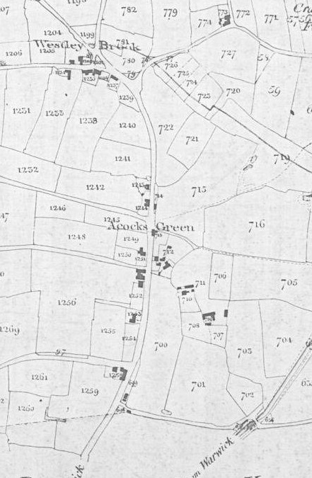
Local historian Bill Dargue describes Acocks Green as one of Birmingham’s “absorbed villages”, which honestly feels like the perfect description. Modern Birmingham gradually expanded outward until places that were once separate rural communities became folded into the city itself. Looking at old maps, you can almost watch that process happening in slow motion.
Coaches, Canals, and an Expanding Birmingham
One of the most important features of Regency Acocks Green was the Warwick Road. Today it is largely associated with traffic congestion, slightly chaotic driving decisions, and the ongoing Birmingham-wide experiment to determine exactly how many potholes one road can physically sustain before collapse.
During the eighteenth and early nineteenth centuries, however, it formed part of an important coaching route linking Birmingham with Warwick, Oxford, and London. The road had been turnpiked in 1725 under the Alcester Turnpike Trust. Essentially, travellers paid tolls which funded road maintenance and improvements. Regency infrastructure, if you will.
By the Regency years, stagecoaches regularly passed through Acocks Green carrying passengers, newspapers, parcels, commercial goods, mail, and undoubtedly a fair amount of gossip from London. In 1818, the Universal British Directory listed numerous coach and carrier services operating through Birmingham’s wider road network, showing just how busy these routes had become. What now feels entirely suburban once formed part of a national transport system powered entirely by horses, toll gates, coaching inns, mud, and stamina.
Inns such as the Dolphin and the Spread Eagle provided places where horses could be changed and travellers fed before continuing their journeys south. I suspect these inns would have brought a surprising amount of activity and information into what otherwise remained a fairly quiet rural community. Travellers carried news, political debate, newspapers, fashions, and stories from elsewhere in the country. Even relatively isolated places were becoming increasingly connected to wider national life.
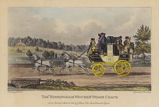
Of course, Regency travel was nowhere near as glamorous as period dramas sometimes suggest. Roads became deeply muddy during winter. Heavy ruts damaged wheels and slowed coaches considerably. Accidents were common enough to regularly appear in newspapers. Long-distance journeys remained exhausting and unpredictable even on improved roads.
Meanwhile Birmingham itself was growing at extraordinary speed nearby. In 1801, Birmingham’s population stood at roughly 74,000 people. By 1831 it had risen to more than 146,000. Places like Acocks Green sat directly on the edge of that transformation, close enough to feel the effects whilst still remaining visibly rural.
Canals and the Real Regency Economy
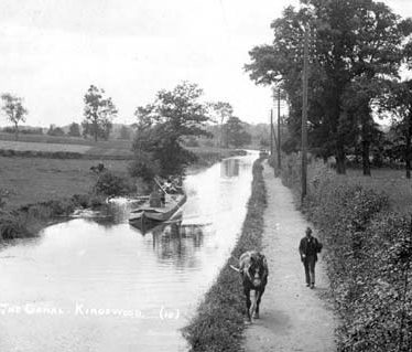
Long before railways arrived, canals had already begun reshaping the area. The Warwick and Birmingham Canal opened in stages between 1793 and 1816, connecting Birmingham with Warwickshire and the growing canal network spreading across industrial Britain.
Canals mattered because moving heavy goods by water was dramatically cheaper and easier than transporting them by road. Narrowboats carried coal, lime, timber, bricks, tiles, agricultural produce, and manufactured goods through the region on a regular basis. For rural communities around Yardley and Acocks Green, the canal quietly connected local life to Birmingham’s growing industrial economy.
This is one of the things I find most interesting about Regency history because the countryside was not sitting quietly waiting for industrialisation to arrive. Rural communities were already adapting to economic change long before railways transformed Britain. Historical records from Yardley and neighbouring districts repeatedly mention brickfields, gravel pits, clay extraction, and tilemaking operating alongside traditional farmland during the late Georgian and early Victorian period.
Many ordinary families combined agricultural labour with seasonal industrial work whenever opportunities arose. Survival often depended upon flexibility rather than stability. I think this is one of the realities often missing from romantic portrayals of the Regency period. Most people were not dancing at Bath assemblies whilst exchanging witty observations beside chandeliers. They were worrying about work, food prices, illness, poor harvests, and how to keep households functioning during periods of enormous economic change.
In 1816, Britain experienced the “Year Without a Summer” following the eruption of Mount Tambora in Indonesia the previous year. Crop failures and rising food prices affected communities across the country. Families around Acocks Green would almost certainly have felt those pressures through rising bread prices and unstable agricultural work. It is one of those moments that reminds us how interconnected the world already was, even in the Regency period. A volcanic eruption on the other side of the world could still affect the price of bread in rural Worcestershire.
The Countryside Beneath the Suburb
One of the most surprising things about Acocks Green is how long it remained semi-rural despite Birmingham expanding around it. The railway did not arrive until 1852 with the opening of Acocks Green Station on the Birmingham and Oxford Junction Railway. Until then, the area still belonged largely to the slower world of canals, horses, toll roads, and agricultural rhythms.
Even later nineteenth-century descriptions still referred to parts of Acocks Green as countryside. Fields stretched between settlements. Cows grazed close to roads. Small farms survived alongside gradually increasing residential development. Birmingham’s suburban expansion happened steadily rather than suddenly, which perhaps explains why traces of the older landscape still survive quietly beneath the modern one if you know where to look. We still referred to the centre of Acocks Green as “The Village” during my childhood.
The Warwick Road still follows its historic route. The canal still cuts through the area. Some property boundaries still reflect older field systems. Beneath the suburban roads and housing estates sits the outline of a much older rural landscape.
Final Thoughts
Perhaps that is what I find most compelling about places like Acocks Green. Not grand houses or famous residents, but the quiet layering of ordinary lives across the same landscape over centuries.
Long before suburban housing estates, traffic queues, and supermarkets arrived, people here were farming fields, repairing coaching roads, steering canal boats, tending livestock, carrying goods towards Birmingham, and trying to adapt to a rapidly changing world. Most of their names are now forgotten, yet traces of their lives still survive quietly beneath the modern landscape if we know where to look.
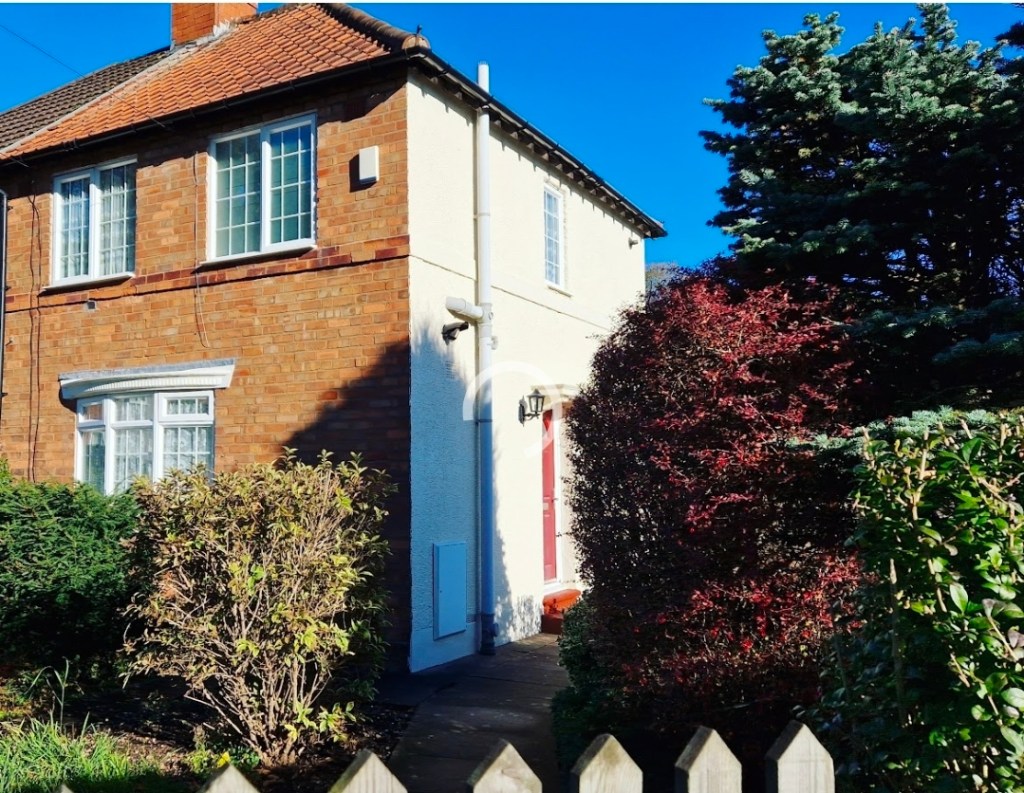
For me, there is also something strangely comforting about realising that the place where I spent my own childhood forms part of a much longer story. My 1930s family home felt modern when I was growing up there, yet historically it sits within the blink of an eye compared to the centuries of rural life that came before it.
History often feels distant when it is presented through palaces, aristocrats, and famous political figures. But standing in a familiar place and realising that Regency travellers once passed along the same road somehow makes the past feel much closer, more human, and far less abstract.
Although I suspect the people of Regency Acocks Green would still have preferred their muddy lanes to modern Birmingham potholes and traffic.
If you know Acocks Green yourself, I would genuinely love to hear your memories of the area too. Perhaps your family lived there for generations, perhaps you remember parts of it before later redevelopment, or perhaps, like me, you simply never realised quite how much history was sitting quietly beneath the everyday landscape.


Comments, insights, and gentle corrections welcome.